dep_index
A Nationwide Community Deprivation Index
Please see the main README for methodological details. This document only contains output relevant to the update from the 2015 version of the index to the 2018 version.
Getting the data
Download the 2018 index CSV file
The data is contained in a CSV file called ACS_deprivation_index_by_census_tracts.csv which is a table of census tracts listed by their FIPS ID and corresponding deprivation index. Also included for each tract are the six individual ACS measures used to create the deprivation index.
Import 2018 index directly into R
Use the following code to download the deprivation index data.frame directly into R:
dep_index <- 'https://github.com/geomarker-io/dep_index/raw/master/2018_dep_index/ACS_deprivation_index_by_census_tracts.rds' %>%
    url() %>%
    gzcon() %>%
    readRDS() %>%
    as_tibble()
2018 ZIP code deprivation index
The deprivation index is also available by zip codes, denoted using the ZIP Code Tabulation Area (ZCTA) boundaries. The value for each ZCTA is calculated as the mean of all of its intersecting census tracts. Download the 2018 file located at 2018_dep_index/ACS_deprivation_index_by_zipcode.csv or use the above code to read it into R by replacing the RDS file name with ACS_deprivation_index_by_zipcode.rds.
Updated PCA results for 2018 ACS data
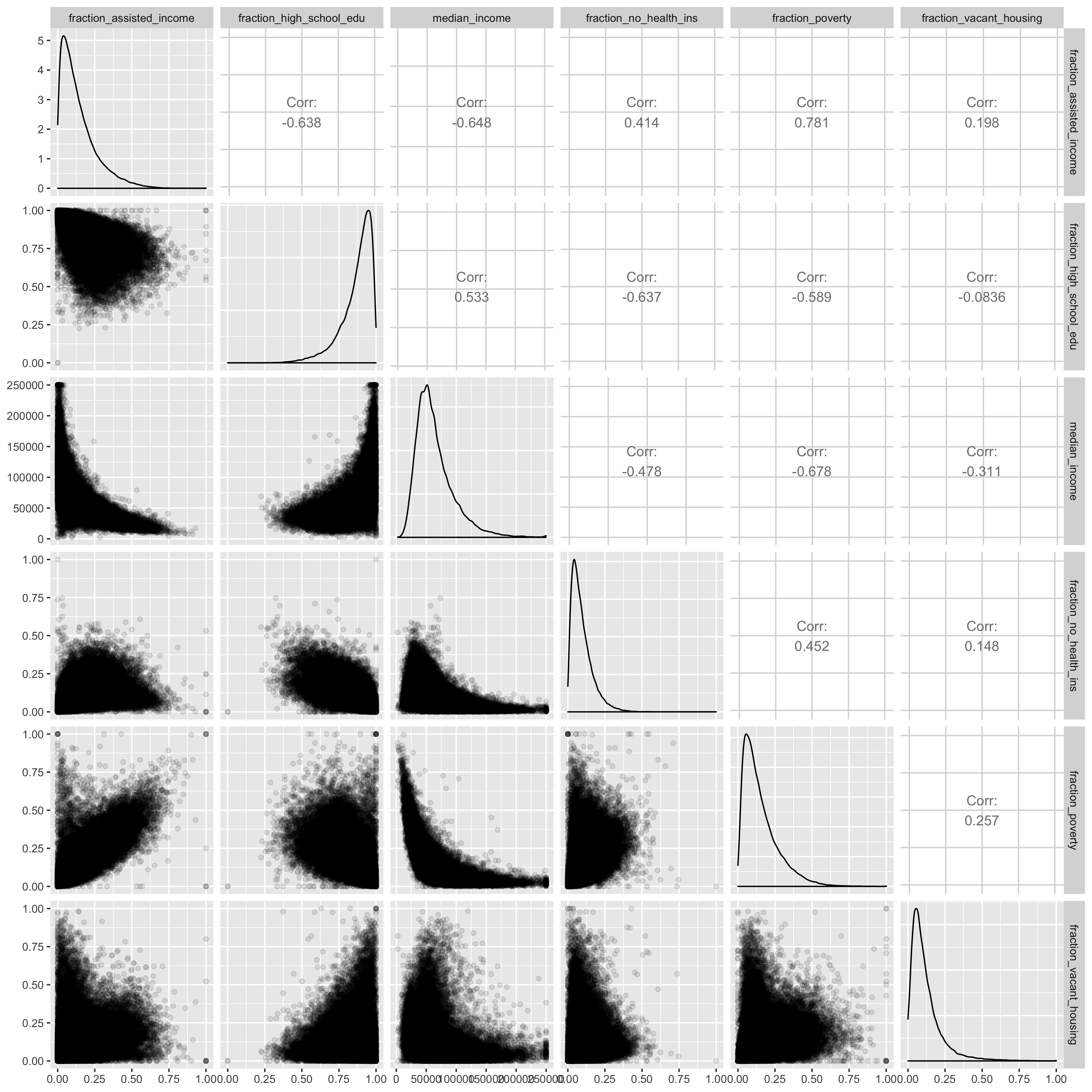
Pairs plot of ACS estimates
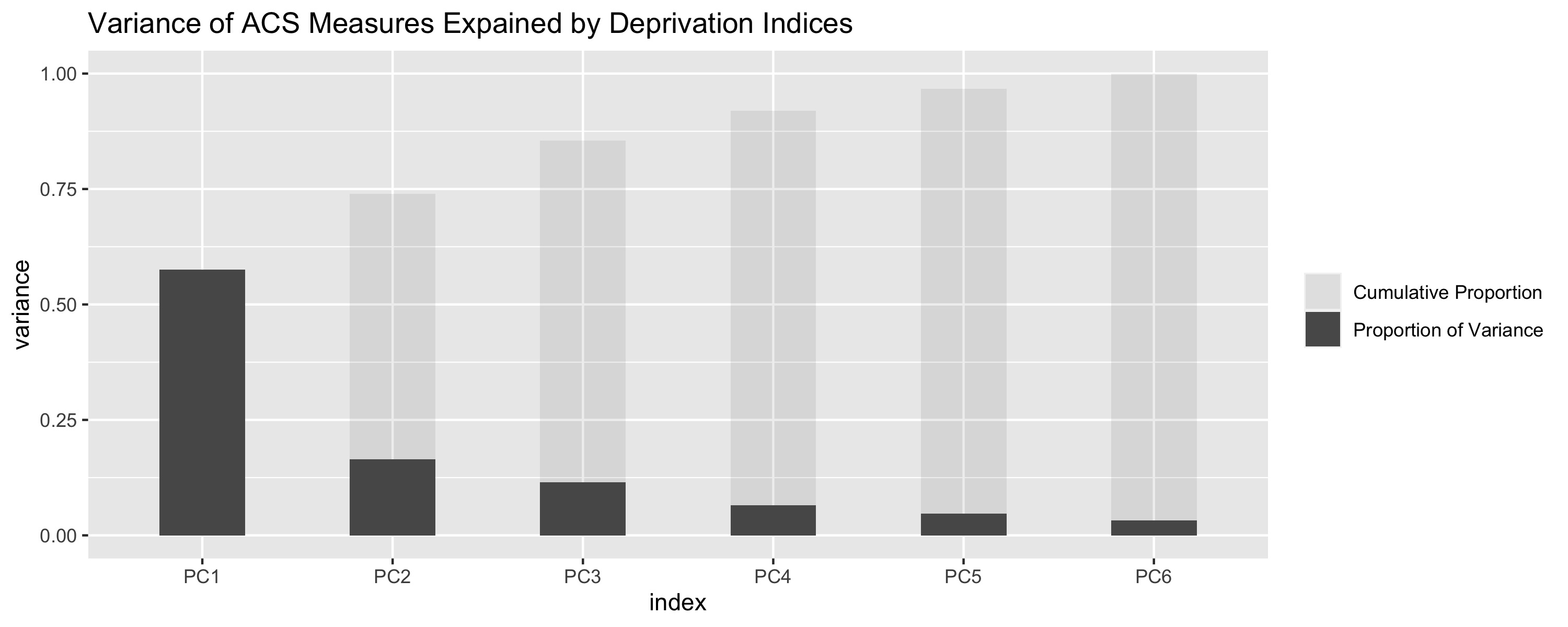
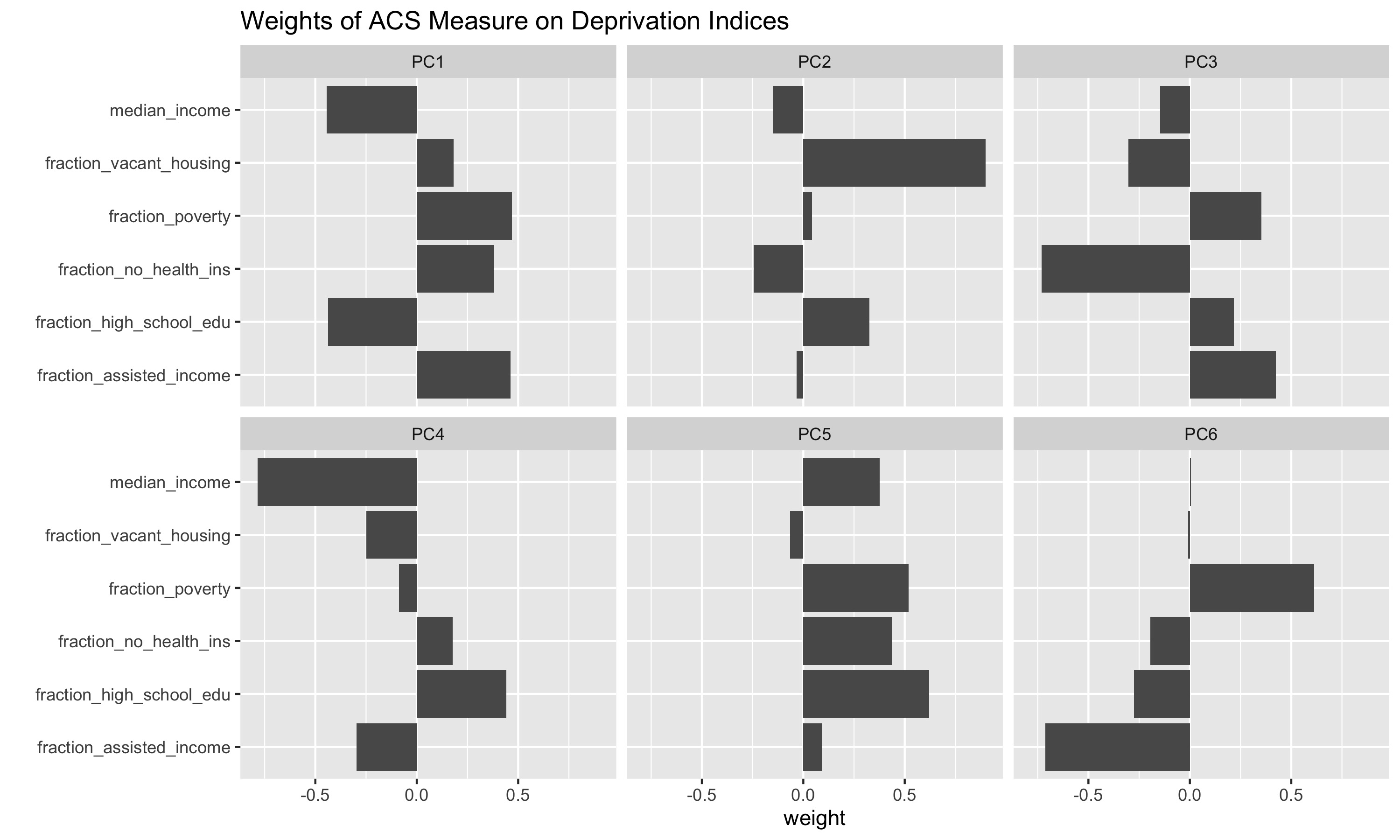
PCA
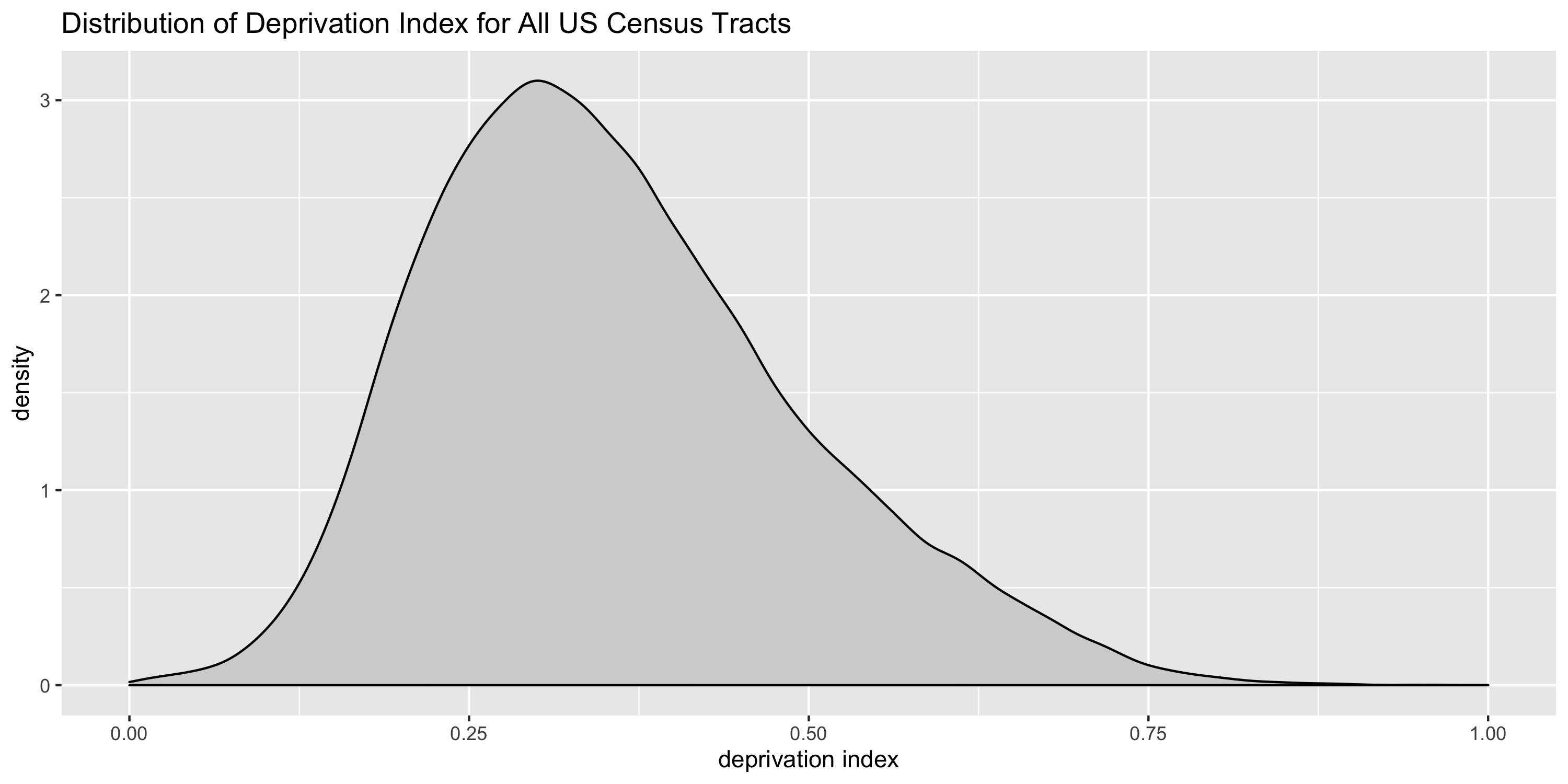
Distribution of index
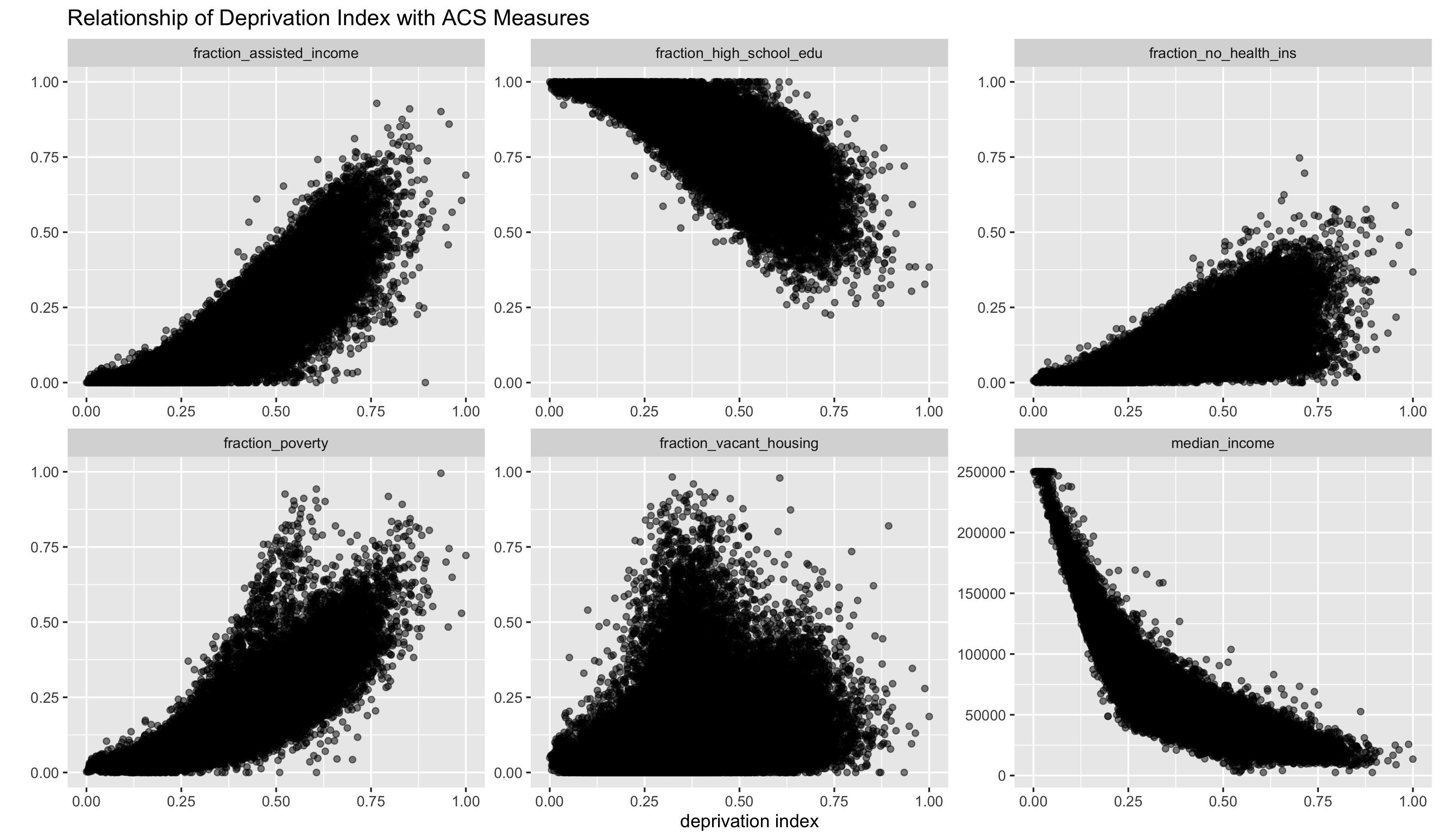
Relationship between index and ACS measure